patrickdunford.nz
-
New Zealand Rail Maps: NZRM Update 2025-02-26
This month the main mapping work completed has been in Volume 1 where the maps of the Donnellys Crossing or Kaihu Branch have been updated. This has been undertaken with assistance from members of the NZ Rail Geography Group on groups.io which is likely to be significantly beneficial to the rest of the project as…
-
New Zealand Rail Maps: NZRM Update 2025-01-22
Apologies for the long delay since the last report (which was sent out December 10 but inadvertently had an earlier date in the title). A lot has been happening with the project since then but it’s mostly been invisible. Firstly, after experimenting for a year with NZ based hosting, the entire site has been rolled…
-
New Zealand Rail Maps: NZRM Progress Report 2024-02-24: Volume 6, 7, 8, 9
As outlined in previous posts, Volume 6 is a priority for completion. The main part of updates to Volume 6 is to update the Wairarapa Line suburban stations with recently obtained 1951 aerial photo coverage, and to add all the current stations on the NIMT between Wellington and Palmerston North that aren’t already mosaiced. NZR…
-
New Zealand Rail Maps: NZRM Progress Report 2024-12-06: Review of Year’s Work
Towards the end of last year, a blog post suggested where work efforts should be directed for 2024. It referred to four volumes that were nearing completion and were hoped to be completed by the end of 2024. These were volumes 6, 7, 8 and 9. Progress has been made in a number of these…
-
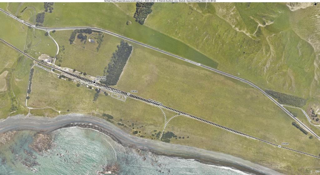
New Zealand Rail Maps: Main North Line: Wharanui To Ward
Well good day and here is some stuff from the Main North Line, which is the current ambit of map production. We are currently filling in some small details of Volume 8 which covers the MNL all the way through from Ashley to Picton, and the Nelson Section. Volume 8 is one of those we…